Subscribe to trusted local news
If you are accessing this story via Facebook but you are a subscriber then you will be unable to access the story. Facebook wants you to stay and read in the app and your login details are not shared with Facebook. If you experience problems with accessing the news but have subscribed, please contact subscriptions@thestrayferret.co.uk. In a time of both misinformation and too much information, quality journalism is more crucial than ever. By subscribing, you can help us get the story right.
- Subscription costs less than £1 a week with an annual plan.
Already a subscriber? Log in here.
01
Jan 2025
Homes at risk as flood warnings issued for Nidd and Ure

Flood warnings are currently in place at three locations on the River Nidd and the River Ure after last night’s persistent rain.
Flood warnings are more serious than flood alerts because they indicate flooding is expected rather than possible.
The Environment Agency said this morning that flooding was expected on the Ure at Boroughbridge, and the river has since burst its banks.
A 3pm update for the river said:
The River Ure level at Westwick Weir was 2.19 metres. Property flooding is possible when it goes above 1.60 metres.

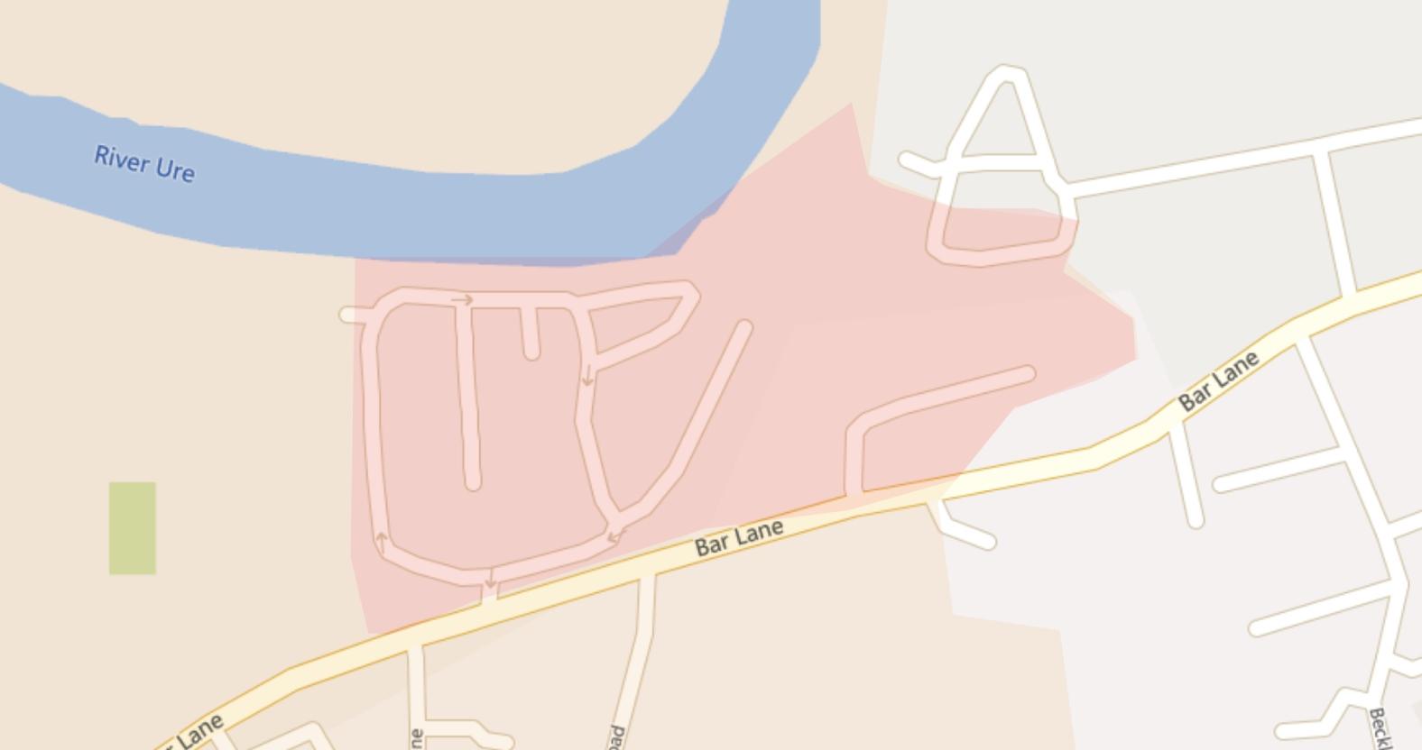
The red area indicates the area most at risk of flooding in Boroughbridge.
The Environment Agency said flooding was expected to continue until later tonight. Areas most at risk include low lying land and roads near the river, particularly around Boroughbridge camping and caravanning site.
The River Nidd at Hunsingore is also expected to flood, particularly around The Old Cornmill. River levels are expected to peak this evening. The level at Hunsingore was 1.68 metres and homes can flood when the level goes above 1.60 metres, a 3pm update said.
A 3pm Environment Agency update for the Ure at Masham said the river level in the town was 3.19 metres and “property flooding is possible when it goes above 3.10 metres”.
Areas most at risk include properties on Mill Gate, Marfield Quarry in Masham and properties off the A6108, with low lying land and roads expected to be most affected.
Less severe flood alerts are also active for the entire River Nidd catchment area as well as the Lower River Ure and the River Crimple catchment.
Elsewhere, the Ripon to Sharow road was closed this afternoon due to flooding.
The Stray Ferret has asked North Yorkshire Council for an update on the A59 road closure at Kex Gill after this morning's inspection but has not had a response.
0